
Das Bedford Basin ist eine große, geschlossene Bucht , die den nordwestlichen Teil des Hafens von Halifax an der kanadischen Atlantikküste bildet . Es ist nach John Russell, dem 4. Herzog von Bedford, benannt .
ExzellentBays of Nova Scotia
Kategorie
7 Artikel
Das Bedford Basin ist eine große, geschlossene Bucht , die den nordwestlichen Teil des Hafens von Halifax an der kanadischen Atlantikküste bildet . Es ist nach John Russell, dem 4. Herzog von Bedford, benannt .

Deadman’s Island ist eine kleine Halbinsel mit Friedhof und Park im Nordwestarm des Hafens von Halifax in Nova Scotia , Kanada.

Melville Island ist eine kleine Halbinsel in Nova Scotia , Kanada, im nordwestlichen Arm des Hafens von Halifax , westlich von Deadman's Island . Sie gehört zur Halifax Regional Municipality .
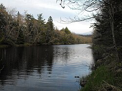
Der Musquodoboit River / ˌ m ʌ sk ə ˈ d ɒ b ɪ t / ist ein kanadischer Fluss im Zentrum von Nova Scotia, im nordöstlichen Teil der Halifax Regional Municipality .

Sable Island ( französisch : île de Sable , wörtlich „Sandinsel“) ist eine Insel im Nordatlantik, etwa 300 Kilometer (160 Seemeilen) südöstlich von Halifax , Kanada, und etwa 175 Kilometer (95 Seemeilen) südöstlich des

Der Sackville River ist ein Fluss im Bezirk Hants und der Halifax Regional Municipality in Nova Scotia , Kanada . Er mündet in das Bedford Basin . Der Little Sackville River ist ein Nebenfluss.
Das Shubenacadie-Tal ist eine ländliche Region in Zentral- Neuschottland, Kanada .