Satara () (ISO: Sātārā) is a city located in the Satara District of Maharashtrastate of India, near the confluence of the river Krishna and its tributary, the Venna.[2] The city was established in the 16th century and was the seat of the Chhatrapati of the Maratha Empire, Shahu I.
It is the headquarters of Satara Tehsil, as well as the Satara District. The city gets its name from the seven forts (Sat-Tara) which are around the city. The city is known as a Soldier's city as well as Pensioner's city. The city had a population of 179,147 in 2011.[3]
History
Raja bhoj II of Shilahara dynasty constructed a fort here between 1178 AD and 1193 AD around which the city was later founded,Shilaharas fell to Seuna (Yadava) dynasty of Devgiri in 1212 AD. Popular among locals, temple of Yavateshwar was built during yadava rule in Hemadpanti style. During rule of Bijapur Sultanate,Ali Adil Shah I's wife Chand Bibi was imprisoned by Kishvar Khan at Satara fort as she conspired against him to seize power after her husband's death. In May 1673, Chhatrapati Shivaji Maharaj conquered Parali(now Sajjangad) and the Satara fort in September of the same year from Bijapur.After which Manaji Sable served as kiledar of Satara and defended the fort when it was attacked by second son of Aurangzeb Muhammad Mu'azzam.
After the death of Chhatrapati Sambhaji (Son of Chhatrpati Shivaji Maharaj) in 1689,Marathas under Rajaram I had to retreat to south India for survival. and hence Jinji in Tamilnadu became the Maratha capital but when Chhatrapati Rajaram returned to Maharashtra in 1698, he declared Satara as the Maratha capital.He then left Satara for campaign and left the fort to Prayagji Prabhu.On 8 December 1699 Aurangzeb advanced towards Satara and sieged the fort with Tarbiyat khan in south,Sarjekhan in east, Aurangzeb's son Azam Shah in Shahapur in the west and Aurangzeb himself in Karanje in the north. Parshuram pant Pratinidhi managed to sent food grain supplies through Parali fort by bribing Azam Shah. Marathas defended the fort for 6 months but news of chh.Rajaram's death demoralized the troops on Satara fort and in April Tarbiyat khan dug trenches under Bastion named Manglai, killing a few Marathas and injuring Prayagji Prabhu, this compelled them to handover the fort. It was later recaptured by Marathas in 1706.
Chhatrapati Shahu Maharaj I Shahu, heir apparent to the Maratha Empire, was captured by Mughals when he was only seven years old at Raigad.He remained their prisoner until the death of Aurangzeb in 1707.
The dowager Maharani Tarabai proclaimed her son, Shahu's younger half-brother Shahu Sambhaji, as the Chhatrapati Maharaj under her regency. The Mughals released Shahu with intentions sparking a Maratha civil war in 1707. The Marathas would face an internal war for the throne. Shahu returned to the Maratha+ Kingdom and claimed his inheritance.
1707 gewann Chhatrapati Shahu , der Sohn von Chhatrapati Sambhaji , die Schlacht von Khed und erreichte schließlich Satara. Dort wurde er in der Festung Satara zum Chhatrapati gekrönt; die Stadt Satara wurde später seine Hauptstadt. Er regierte das Maratha-Reich 42 Jahre lang und dehnte es auf weite Teile Indiens aus. Er gründete 13 Pethas (Stadtteile) in Satara und die Stadt Shahunagar am östlichen Fuße der Festung, wo später der Thron aufbewahrt wurde. Der Thron (Gaadi) stand zunächst in der Festung Satara; nach Kriegsende und der Sicherung der Stadt ließ er ihn dorthin bringen. Unter seiner Herrschaft erlebte Satara die Blütezeit seines politischen Einflusses und großen Wohlstands. Da er keinen Sohn hatte, ernannte er Tarabais Enkel Rajaram II. zum Thronfolger. 1750 ließ Tarabai aufgrund interner Machtkämpfe Chhatrapati Rajaram II. gefangen nehmen. Balaji Bajirao belagerte daraufhin die Festung Satara und erreichte schließlich, dass Tarabai einen Friedensvertrag unterzeichnete. Im Vertrag von Sangola trat Rajaram II. seine Macht an den Peshwa ab. Viele Ämter der Maratha-Verwaltung wurden von Satara nach Pune verlegt. Satara verlor an politischer Bedeutung, und das Maratha-Reich zerfiel in der Folge zu einem Staatenbund. Rajaram II. regierte bis Dezember 1777 nur lose. Da er kinderlos war, adoptierte er Chhatrapati Shahu II. von den Bhosales von Wavi. Dieser regierte bis 1808 und wurde von Chhatrapati Pratapsinha I. abgelöst. Das Maratha-Reich fiel an die Britische Ostindien-Kompanie, und Satara wurde zu einem Rumpfstaat. Der letzte Maratha-Kaiser, Chhatrapati Pratapsinha, wurde des Hochverrats gegen die Briten angeklagt, und sein Bruder wurde zum König ernannt. Er hatte keinen Sohn. Satara war der erste Staat, der 1848 im Rahmen der „ Doktrin des Heimfalls “ des britischen Generalgouverneurs Dalhousie annektiert wurde .
Während der Quit-India-Bewegung wurde in Satara eine Schattenregierung gebildet . [ 4 ]
Neuere Geschichte
Nach der Unabhängigkeit wurde Satara aufgrund einer sprachlichen Neuordnung Teil der Präsidentschaft Bombay. Satara verfügt über bedeutende politische Macht und übt erheblichen Einfluss auf die Politik Maharashtras aus. Die direkten Nachkommen von Chhatrapati Shivaji leben weiterhin in Satara. Chhatrapati Udayanraje Bhonsle ist der 13. Nachkomme Shivajis . [ 5 ]
Geographie

Satara is located at 17°41′N73°59′E / 17.68°N 73.98°E.[6] It lies in the Satara District.[7] Satara city is surrounded by seven mountains. Satara lies on the slope of Ajinkyatara fort.[8] It lies on the western side of the Deccan Plateau. Pune (110 km), Sangli (121 km), Kolhapur (122 km) and Solapur (263 km) are the main cities close to Satara.[7] The city is surrounded by the tehsils of Koregaon on the West, Karad (51 km) and Patan on the South, Jawali on the East and Wai on the North.[7]
National Highway 48 (formerly National Highway 4) passes through Satara, between Karad and Khandala.[9]Kaas Plateau, a valley of flowers, is situated 25 km away from Satara .[10]
The Satara District experiences earthquakes of minor magnitudes. the epicenter of these earthquakes are scattered in Patan Taluka.[8]
Satara is famous for the Kaas Pathar, Thoseghar, and a lot of natural sites present in the vicinity of the city. Kass Plateau has been awarded as a UNESCO's World Heritage Site (WHS). In the monsoon months, the Kaas Pathar, as it is locally known, transforms into a wildflower wonderland. More particularly so in September when vivid shades of pink balsams, yellow Smithia flowers, and blue utricularias carpet the vast grasslands. It is a must-visit for serious botanists, amateur photographers to witness the spectrum of Western Ghats monsoon montane grasslands flora, some of which are rare and endangered.[11]
Climate
Satara city has a tropical wet and dry climate (Köppen climate classification: Aw) that is influenced by the relatively high altitude and mountains surrounding the city. Summers are more hot than the winters. Satara city receives rainfall from 900 mm to 1,500 mm depending on the strength of the monsoon.
| Climate data for Satara (1991–2020, extremes 1933–2020) | |||||||||||||
|---|---|---|---|---|---|---|---|---|---|---|---|---|---|
| Month | Jan | Feb | Mar | Apr | May | Jun | Jul | Aug | Sep | Oct | Nov | Dec | Year |
| Record high °C (°F) | 35.8(96.4) | 38.0(100.4) | 40.5(104.9) | 42.4(108.3) | 42.1(107.8) | 41.2(106.2) | 35.2(95.4) | 35.2(95.4) | 34.6(94.3) | 37.7(99.9) | 36.0(96.8) | 34.7(94.5) | 42.4(108.3) |
| Mean daily maximum °C (°F) | 30.5(86.9) | 32.9(91.2) | 36.2(97.2) | 38.1(100.6) | 37.4(99.3) | 30.9(87.6) | 27.3(81.1) | 26.9(80.4) | 29.2(84.6) | 31.4(88.5) | 31.1(88.0) | 30.2(86.4) | 31.8(89.2) |
| Mean daily minimum °C (°F) | 12.4(54.3) | 14.2(57.6) | 17.7(63.9) | 21.1(70.0) | 22.8(73.0) | 22.6(72.7) | 21.8(71.2) | 21.2(70.2) | 20.6(69.1) | 19.4(66.9) | 16.1(61.0) | 13.2(55.8) | 18.6(65.5) |
| Record low °C (°F) | 4.8(40.6) | 5.8(42.4) | 9.1(48.4) | 12.3(54.1) | 15.2(59.4) | 18.0(64.4) | 19.0(66.2) | 14.5(58.1) | 14.5(58.1) | 13.2(55.8) | 9.0(48.2) | 7.3(45.1) | 4.8(40.6) |
| Average rainfall mm (inches) | 0.8(0.03) | 0.3(0.01) | 5.8(0.23) | 13.9(0.55) | 27.7(1.09) | 194.5(7.66) | 238.1(9.37) | 194.6(7.66) | 120.2(4.73) | 112.7(4.44) | 21.6(0.85) | 5.1(0.20) | 935.2(36.82) |
| Average rainy days | 0.1 | 0.1 | 0.4 | 1.3 | 1.9 | 10.3 | 16.0 | 12.8 | 8.4 | 6.3 | 1.6 | 0.4 | 59.7 |
| Average relative humidity (%) (at 17:30 IST) | 37 | 30 | 28 | 33 | 43 | 70 | 78 | 79 | 71 | 58 | 48 | 42 | 52 |
| Source 1: India Meteorological Department[12][13][14] | |||||||||||||
| Source 2: Government of Maharashtra[15] | |||||||||||||
Demographics
As of 2011 India census,[16] Satara had a population of 120,079; 61,129 are males while 59,066 are females, thus males constituted 52% of the population and females 48%.[17] Satara has an average literacy rate of 80%, higher than the national average of 74%: male literacy is 84%, and female literacy is 76%. In Satara, 10% of the population is under 6 years of age. Marathi is the native and most widely spoken language. Around 98.5% Speakers are Marathi. Hindi is spoken by 1.5% of the population.
Maharashtra state's sex ratio is 883 girls per 1000 boys, and Satara fares worse still at 881, in spite of the high level of literacy.[18]
The population of Satara has crossed the municipal limits and actual urban agglomerate population 326,765. The city is surrounded with census towns viz. Khed, Godoli and Vilaspur. These census towns are considered as suburban of Satara city.
The nod for Satara city,[19] limit expansion was given by Devendra Fadnavis then chief minister of Maharashtra on 16 September 2019. The matter was pending for 40 years. The city's border will be extended to NH4 towards east, to Ajinkyatara on the south, the whole region south to Venna River, Shahupuri, Sambhajinagar, Vilaspur and Dare Budruk grampanchayats will become a part of Satara city.
Government and politics
Satara city falls under Satara Lok Sabha constituency, represented by MP Udayanraje Bhosale from the Bharatiya Janata Party.[20] The city also elects an MLA from the Satara Vidhan Sabha constituency, represented by BJP's Shivendrasinh Abhayasinh Bhosale.[21][22]
Civic administration
Satara is a Municipal Council city in district of Satara, Maharashtra.[23] Satara Municipal Council, with population of about 1.2 lakh is Satara sub district's only municipal council located in Satara sub district of Satara district in the state Maharashtra in India.[24] Total geographical area of Satara municipal council is 8 square km. Population density of the city is 14748 persons per square km.[25]
The Satara city is divided into 39 wards for which elections are held every 5 years.[17] Among them Satara Ward No 19 is the most populous ward with population of 4691 and Satara Ward No 23 is the least populous ward with population of 2206.[17]
Civic utilities
Water from the Kaas lake is supplied to Satara city for drinking purposes.[26] Maharashtra Jeevan Pradhikaran supplies water to Satara city.[27] 19 MLD is supplied, but because of water leakage during transmission, only 17.2 MLD gets supplied effectively.[28]
Satara Municipal Council is responsible for providing sanitation and solid waste management services in the city, through private contractors.[28] 70 MT/day of solid waste is generated per day. 18 Mt/ day is disposed off through composting.[29] 8.17 km2 of the city, covering 20972 households, are covered under door to door collection.[30]
12.8 MLD of sewage is generated in the city.[29] Satara Municipal Council has plans to construct an STP of 17.5 MLD capacity.[29]
The Maharashtra Right to Public Service Act, 2015 is a revolutionary Act.[31] Citizens can get complete information regarding which services are available under this Act by accessing either the mobile app RTS Maharashtra or ‘Aaple Sarkar’ Web Portal.[31] Citizens can even apply online for availing these services.[31]
Economy
Sugarcane is the single biggest crop of Satara along with turmeric and ginger. The Satara district has around 302 banks. The per capita of Satara district is nearly 1.2 times the state average.[32] The British had, during the pre-Independence period started a variety of industries in Satara for Menthol and soap manufacturing in 1905. Bigger industries for copper were started in 1922. After independence, the whole district was stagnant in industrial growth. From 1950 to 1960, industrial growth restarted and the manufacture of jaggery was started in the Satara Tehsil area. There is tanning industry in Satara city. It existed during the British rule, and after independence, the Maharashtra government established a modern tanning center in 1957.[33]

Tourism


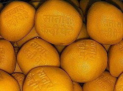
The famous tourist points near Satara city are:
- Ajinkyatara Fort (अजिंक्यतारा किल्ला)
- Jarandeshwar Hanuman - Satara Koregaon Road
- Bajirao Vihir in shukrwar peth, Satara
- Vajrai Waterfall- tallest Waterfall in India.
- Sajjangad Fort (सज्जनगड किल्ला)
- Kaas-Plateau – auch bekannt als „Tal der Blumen von Maharashtra “ und gleichzeitig Weltkulturerbe
- Der Stufenbrunnen Baramotichi Vihir befindet sich in der Nähe des Dorfes Limb, etwa 16 km von Satara entfernt.
- Thoseghar-Wasserfall
- Shree Uttar Chidambaram Natraj Tempel Satara
- Yewateshwar
- Bamnoli
- Dhom-Damm
- Urmodi-Staudamm
- Raje Baksavar Peer Saaheb Dargha (Khatgun)
- Chaphal (Shree Ram Mandir, in der Nähe von Umbraj) [ 35 ]
Sonnenuntergangsblick vom Naryan Maharaj Math, Bamnoli
- Paratapgad liegt 75 km nordwestlich von Satara
Die historische Bedeutung der Festung beruht auf der Schlacht von Pratapgad, die hier am 10. November 1659 zwischen Chhatrapati Shivaji und dem General des Sultanats von Bijapur, Afzal Khan, stattfand. Nach der Tötung Afzal Khans durch Chhatrapati Shivaji errangen die Marathen einen entscheidenden Sieg über die Armee von Bijapur.
- Panchgani liegt 50 km von Satara entfernt. Panchgani, auf Marathi Paachgani (पाचगणी) genannt, ist ein Bergort und eine Gemeinde im Distrikt Satara.
Kultur
Sehenswürdigkeiten


Satara liegt am Fuße der berühmten Festung Ajinkyatara auf dem Kas-Plateau (auch Blumenplateau genannt), das heute zum UNESCO-Weltnaturerbe gehört. [ 34 ] Im Herzen der Stadt befinden sich zwei Paläste: der Alte Palast (Juna Rajwada) und der Neue Palast (Nava Rajwada), die direkt aneinandergrenzen. Der Alte Palast wurde vor etwa 300 Jahren, der Neue Palast vor etwa 200 Jahren erbaut.
Satara besitzt eine einzigartige Statue von Shivaji, der in der Nähe einer Kanone am Powai Naka steht. Üblicherweise zeigen Statuen von Shivaji ihn reitend auf einem Pferd.
Die Thoseghar-Wasserfälle , etwa 20 km westlich von Satara, zählen zu den beliebtesten Ausflugszielen in den Westghats während des Monsuns . Besucher aus ganz Maharashtra kommen hierher, besonders in der Monsunzeit zwischen Juli und Oktober. Der Vajrai-Wasserfall , Indiens höchster Wasserfall, liegt etwa 22 km von Satara entfernt. Das Fort Sajjangad ist rund 15 km von Satara entfernt.
Satara ist jedes Jahr Austragungsort des Satara-Halbmarathons. [ 36 ] Im Jahr 2015 wurde der Lauf mit 2.618 Teilnehmern ins Guinness-Buch der Rekorde für die meisten Teilnehmer an einem Berglauf (einzelner Berg) aufgenommen. [ 37 ] [ 38 ]
Apshinge Military ist ein kleines Dorf im Distrikt Satara. Mindestens ein Mitglied jeder Familie im Dorf hat in den Streitkräften gedient oder dient dort aktuell. Die britische Regierung errichtete im Dorf ein Denkmal zum Gedenken an die 46 Soldaten, die im Ersten Weltkrieg gefallen sind. [ 39 ]
Ausbildung
Satara is well known for Sainik School, Satara - The first among the chains of Sainik Schools established in the country on 23 June 1961 under the Ministry of Defence.[40] Satara has base of Rayat education institutes. Yashavantrao Chavan Institute of Science [41] is one of the famous institute from District. Rayat Shikshan Sanstha's Karmaveer Bhaurao Patil college of engineering, Satara[42] is the oldest engineering college in Satara city. Government Medical College (GMC), Satara had its first batch graduation in the year 2022. It is located near the Civil Hospital Satara[43]
- KSD Shanbhag Vidyalaya (1990)
- Government Medical College[44] (2022)
Notable people
- Hari Makaji Naik
- Jagannath Raoji Chitnis
- Sai Bhosale
- Yashwantrao Chavan
- Tanaji Malusare
- Rani of Jhansi
- Jyotirao Phule
- Bhaurao Patil
- Krantisinha Nana Patil
- Khashaba Dadasaheb Jadhav
- Col Santosh Mahadaik
- Narendra Dabholkar
- Shivendra Raje Bhosale
- Sayaji Shinde
- Lalita Babar
- Sharad Pawar
- Shahir Sable
- Bal Kolhatkar
Transport
Road links
Satara is about 250 km from Mumbai on National Highway 48 (via Mumbai Pune Expressway and PB road) and 110 km away from Pune. A bypass on Highway 48 was constructed to avoid traffic congestion in the city. National Highway 965D connects Kedgaon, Supe, Morgaon, Nira, Lonand, Wathar up to Satara. National Highway 548C starts from Satara. Satara-Akluj-Latur Highway connects Satara to Latur. It passes through Koregaon, Pusegaon, Mhaswad, Akluj, Tembhurni and Murud. It will also be a 4 lane highway, work is going to start soon. State Highway 58 connects Satara with Mahabaleshwar and Solapur. Satara MahadBankot is a newly declared national highway connecting Satara to the Konkan region.
Bus links
Private and government state transport buses are available from Borivali, Dadar, Mumbai Central, and Thane to Satara.
Air links
Pune Airport is the nearest airport.
Railways
Satara railway station lies on the Pune-Miraj line of the Central Railways and is administered by the Pune Railway Division. The station is situated near Mahuli about 0.7 km from the Satara bus stand on the Satara Pandharpur road. Satara is On Route from Mumbai to Miraj, Sangli, Kolhapur, and Bangalore (some trains). Dadar Hubli Express, Koyna Express, Mahalaxmi Express, Maharashtra Express, Goa Express are daily trains that have stops at Satara.
See also
References
- ^"सातारा हद्दवाढ भागात नवे 8 प्रभाग : प्रारुप रचना जाहीर". 11 March 2022.
- ^Chisholm, Hugh, ed. (1911). . Encyclopædia Britannica. Vol. 24 (11th ed.). Cambridge University Press. p. 227.
- ^"सातारा हद्दवाढ भागात नवे 8 प्रभाग : प्रारुप रचना जाहीर". 11 March 2022.
- ^Swami, V.N. (2020). Vidyabharti D.C.C. Bank (Bank clerk examination) (in Marathi). Latur, Maharashtra, India: Vidyabharti Publication. p. 191.
- ^"Satara District : Historical reference". www.satara.gov.in.
- ^"Maps, Weather, and Airports for Satara, India". Fallingrain.com. Retrieved 18 August 2017.
- ^ abc"GEOGRAPHICAL FEATURES OF SATARA DISTRICT"(PDF).
- ^ ab"Groundwater Surveys and Development Agency Website".
- ^"Satara District Map". Mapsofindia.com. Retrieved 31 March 2015.
- ^"Official Website Of Kaas". www.kas.ind.in. Retrieved 16 January 2020.
- ^"UNESCO's World Heritage Site Kaas Plateau". 7 August 2019.
- ^"Climatological Tables of Observatories in India 1991-2020"(PDF). India Meteorological Department. Retrieved 8 April 2024.
- ^"Station: Satara Climatological Table 1981–2010"(PDF). Climatological Normals 1981–2010. India Meteorological Department. January 2015. pp. 685–686. Archived from the original(PDF) on 5 February 2020. Retrieved 10 April 2020.
- ^"Extremes of Temperature & Rainfall for Indian Stations (Up to 2012)"(PDF). India Meteorological Department. December 2016. p. M152. Archived from the original(PDF) on 5 February 2020. Retrieved 10 April 2020.
- ^"Climate". Government of Maharashtra. Retrieved 10 April 2020.
- ^Cities having population 1 lakh and above. Censusindia.gov.in
- ^ abc"NSDL Tax Information Network (TIN) - Search". tin.tin.nsdl.com. Retrieved 23 September 2020.
- ^Babu, Chaya. 285 Indian girls no longer called "unwanted". Associated Press via NBC News. 22 October 2011
- ^सातारा न.पा. हद्द वाढ सातारा न.पा. हद्द वाढ (पी.डी.एफ.). "सातारा न.पा. हद्द वाढ | District Satara, Government of Maharashtra, India | India". Satara.gov.in. Retrieved 18 July 2022.
- ^"NCP's Shriniwas Patil Who Won Satara In Prestige Battle With BJP Sworn In". NDTV.com. Retrieved 24 September 2020.
- ^District wise List of Assembly and Parliamentary Constituencies. Chief Electoral Officer, Maharashtra website.
- ^"Bhonsle Shivendrasinh Abhaysinh(Nationalist Congress Party(NCP)):Constituency- Satara(SATARA) - Affidavit Information of Candidate". myneta.info. Retrieved 24 September 2020.
- ^"Municipal Council, Satara | District Satara, Government of Maharashtra, India | India". Retrieved 23 September 2020.
- ^"Cenus 2011".
- ^"Census 2011".
- ^"GEOGRAPHICAL SET UP OF THE STUDY REGION"(PDF).
- ^"Drinking Water Quality in Distribution System of Satara City Maharashtra". Retrieved 9 December 2020.
- ^ ab"Road Map towards 24x7 Water Supply in Class 'A' Municipal Councils in Maharashtra"(PDF). Retrieved 9 December 2020.
- ^ abc"Action Plan Priorities - Venna"(PDF). Maharashtra Pollution Control Board. Retrieved 9 December 2020.
- ^"Solid Waste Management Information"(PDF). National Solid Waste Association of India.
- ^ abc"Right to Service | District Satara, Government of Maharashtra, India | India". Retrieved 5 September 2020.
- ^Seetharaman, G. (20 November 2016). "Demonetisation: Satara farmers willing to bite the bitter bullet". The Economic Times. Retrieved 16 January 2020.
- ^"INDUSTRIAL DISTRIBUTION AND DEVELOPMENT IN SATARA TEHSIL"(PDF).
- ^ abMulla, Mohsin (4 July 2012). "Kaas to bloom for only 2,000 tourists daily". Dnaindia.com.
- ^"VirajTravels – Perfect place to find all holiday packages". virajtravels.in. Retrieved 18 August 2017.
- ^"Satara Hill Half Marathon on September 6 - Times of India". The Times of India. Retrieved 25 October 2017.
- ^Avlani, Shrenik (4 January 2016). "Runs you cannot miss in 2016". livemint.com/. Retrieved 25 October 2017.
- ^"Most people in a mountain run - single mountain". Guinness World Records. Retrieved 25 October 2017.
- ^"Recognise our WWI sacrifices: Apshinge Military villagers". 19 August 2013.
- ^"Sainik School Satara". Sainiksatara.org. Retrieved 18 July 2022.
- ^"Yashwantrao Chavan Institute of Science,Satara| Home :: Science College". Ycis.ac.in. Retrieved 18 July 2022.
- ^"Karmaveer Bhaurao Patil College of Engineering, Satara".
- ^"District Hospital, Satara · M2R5+HQ4, Sadarbazar, Guruwar Peth, Satara, Maharashtra 415002, India". District Hospital, Satara · M2R5+HQ4, Sadarbazar, Guruwar Peth, Satara, Maharashtra 415002, India. Retrieved 27 November 2022.
- ^"sequentia". www.gmcsatara.org. Retrieved 27 November 2022.
Further reading
- Paul H. von Tucher: Nationalismus: Fall und Krise in der Mission – Deutsche Missionen in Britisch-Indien 1939 – 1946. Diss. Erlangen 1980. Autorenausgabe Erlangen/Deutschland 1980. Lesen Sie SATARA .
- Wilhelm Filchner: Das Leben eines Forschers (Kapitel XXIII). Wilhelm Filchner war von September 1941 bis November 1946 im Parole Camp in Satara interniert.
- Ausgewählte Schriften aus den historischen Aufzeichnungen des Erbministers von Baroda. Bestehend aus Briefen der Regierungen von Bombay, Baroda, Poona und Satara . Gesammelt von B. A. Gupte. Kalkutta 1922.
- Malik, SC Steinzeitindustrien der Bombay & Satara Distrikte , M. Sayajirao Universität Baroda 1959.
- Irawati Karve, Jayant Sadashiv Randadive, Die soziale Dynamik einer wachsenden Stadt und ihrer Umgebung . Deccan College, 1965, Pune. ISBN B0000CQW3J
- Valunjkar, TN Soziale Organisation, Migration und Wandel in einer Dorfgemeinschaft , Deccan College Poona 1966.
- Dr. B. R. Ambedkar beschreibt seine Erfahrungen als Kind in Satara in seinem autobiografischen Buch „ Waiting for a Visa“ [1].


